Skip to content
MathsGenie logo
Open app

Course home

  1. IGCSE
  2. Geography Edexcel
  3. Question bank

Coastal environments

EasyMediumHard
1234567891011121314151617181920212223242526272829303132
Question 29

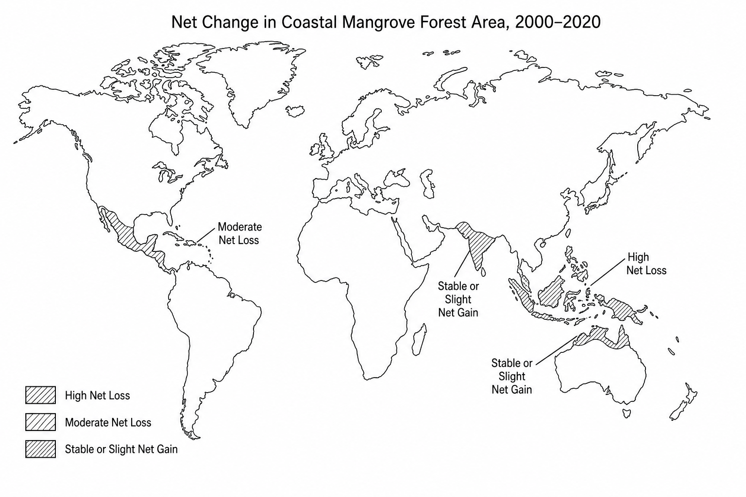
Study Figure 5a, a map showing the net change in coastal mangrove forest area between 2000 and 2020.

World map showing the net change in mangrove forest area between 2000 and 2020. The map highlights key coastal regions: Southeast Asia (e.g. Indonesia, Myanmar) showing high net loss; South Asia (e.g. India, Bangladesh) showing stable or slight net gain; Central America & Caribbean showing moderate net loss; and Northern/Western Australia showing stable or slight net gain.

Suggest two reasons for the pattern of mangrove forest change shown in Figure 5a.
[4]

Coastal environments Questions

  1. IGCSE
  2. /Geography
  3. /Coastal environments

