Skip to content
MathsGenie logo
Open app

Course home

  1. IGCSE
  2. Geography Edexcel
  3. Question bank

Coastal environments

EasyMediumHard
1234567891011121314151617181920212223242526272829303132
Question 25

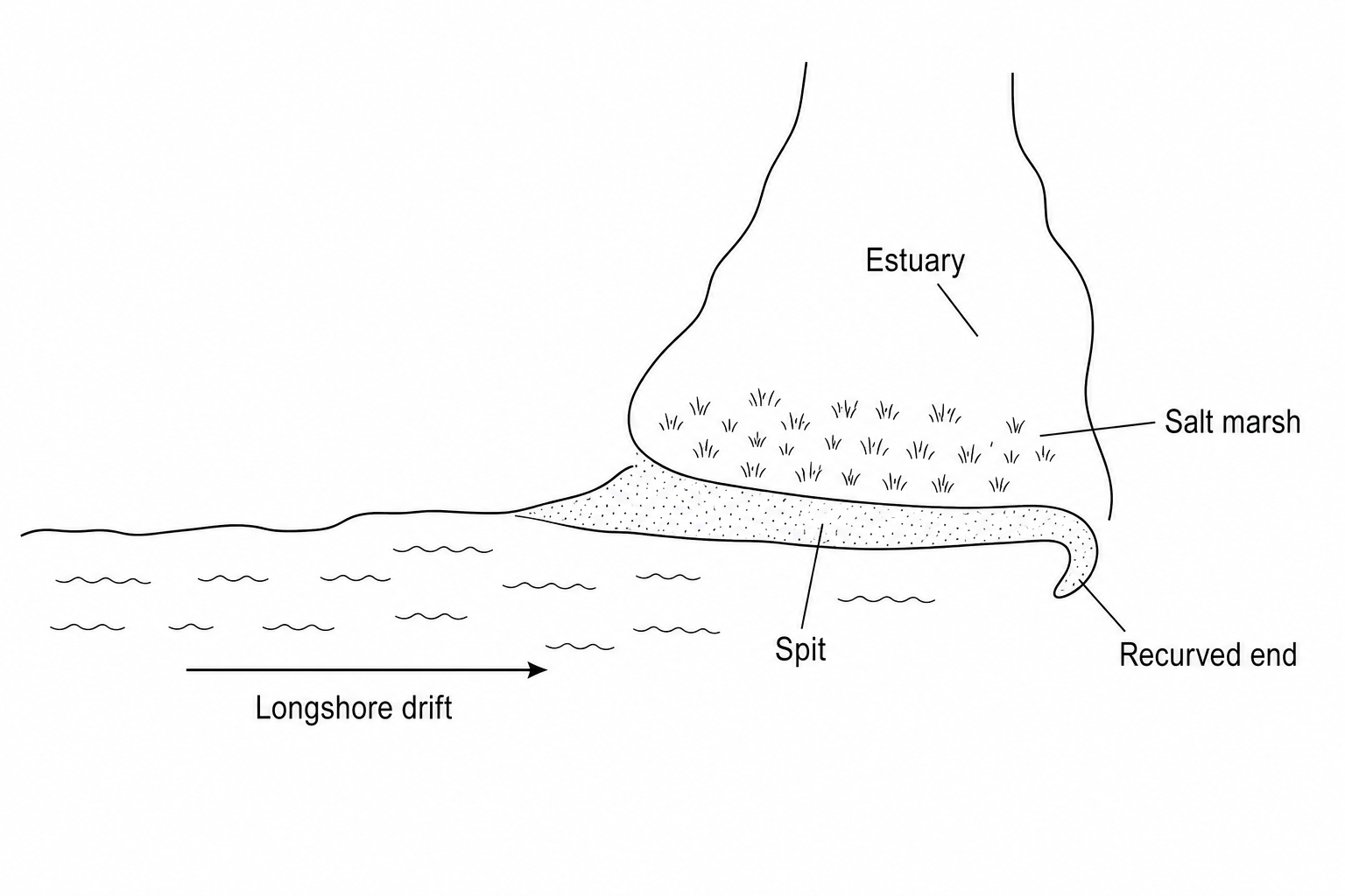
Study Figure 2a, a sketch map showing a coastal spit and salt marsh.

Figure 2a: A sketch map of a coastal spit. It shows longshore drift carrying sediment from west to east. Where the coastline bends northwards into an estuary, a spit extends across the estuary mouth. The recurved spit end points landward. Behind the spit, in the calm, sheltered estuary waters, a salt marsh is labelled as forming on deposited mud and silt layers.

Suggest two ways deposition has influenced the development of the coastal landforms shown in Figure 2a.

[4]

Coastal environments Questions

  1. IGCSE
  2. /Geography
  3. /Coastal environments
