Study Fig. 2, which is a proportional symbol map showing municipal waste generation across different districts of an administrative region.
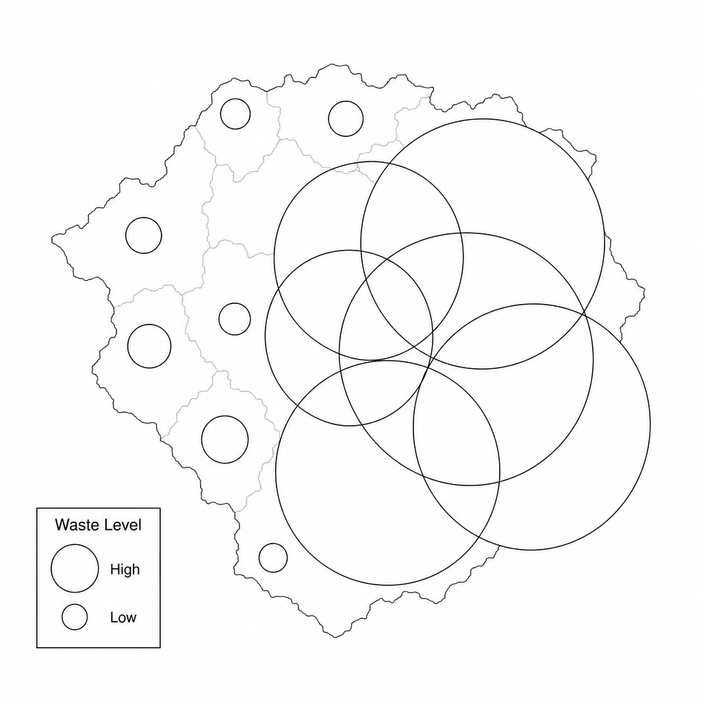
Suggest one way to improve how the geographical information in Fig. 2 is presented. Explain your answer.
Practise OCR A GCSE Geography Visual and source skills with exam-style questions for GCSE Geography. 18 questions, matched to the OCR A GCSE Geography (J383) specification and written in Component 01, Component 02 and Component 03 style. Every question includes a full worked solution and mark scheme, so you can see where marks are awarded rather than just whether you got the answer right.

