Skip to content
MathsGenie logo
Open app

Course home

  1. GCSE
  2. Geography OCR A
  3. Question bank

UK city case study

EasyMediumHard
123456789101112131415161718
Question 12

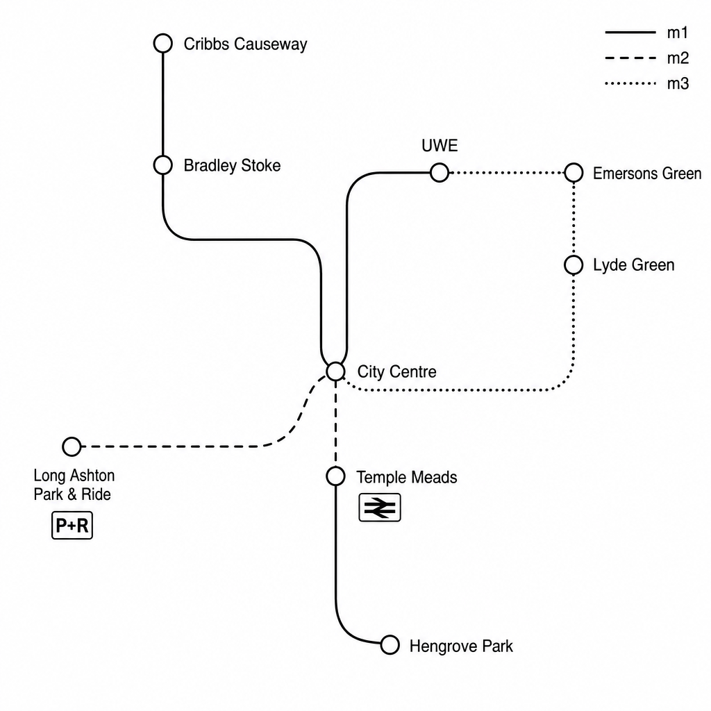
Study Figure 1, which shows the routes of the Bristol MetroBus rapid transit network.

A simplified route map of the Bristol MetroBus network showing three routes: m1, m2, and m3. The m1 route runs north to south, connecting Cribbs Causeway (a major out-of-town retail and entertainment hub) in the north-west, through Bradley Stoke (residential suburb), the University of the West of England (UWE campus), the City Centre, and ending at Hengrove Park (residential and community hospital site) in the south. The m2 route links Long Ashton Park & Ride in the south-west directly to the City Centre and Temple Meads Railway Station. The m3 route links Emersons Green (residential area and Science Park) in the east, through Lyde Green and UWE, to the City Centre. Transport interchange icons are shown at Temple Meads and the Park & Ride. Only key stops are labeled, showing dedicated bus lanes and priority signaling along major roads.

Suggest how the routes of the Bristol MetroBus network benefit the city.
[4]

UK city case study Questions

  1. GCSE
  2. /Geography
  3. /UK city case study

