Case study of a major UK city

EasyMediumHard
1234567891011121314151617181920212223242526272829303132333435363738394041424344454647484950515253545556575859
Question 40
Easy

Study the simulated Ordnance Survey (OS) map extract description of Exeter below:
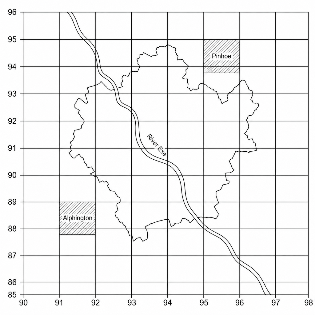
Ordnance Survey (OS) map extract of Exeter. The map features the city boundary and surrounding commuter settlements. The grid system shows Eastings from 90 to 98 and Northings from 85 to 96. In grid square 9188, a built-up residential suburb in the south-west of the city is clearly labelled as 'Alphington'. In grid square 9594, a modern expansion suburb in the north-east is labelled as 'Pinhoe'.

Name the two suburbs of Exeter located in the following grid squares:

a.

9188

[1]
b.

9594

[1]

Case study of a major UK city Questions

  1. GCSE
  2. /Geography
  3. /Case study of a major UK city