Skip to content
MathsGenie logo
Open app

Course home

  1. IGCSE
  2. Geography Edexcel
  3. Question bank

Fragile environments and climate change

EasyMediumHard
12345678910111213141516171819202122232425262728293031323334353637383940414243444546474849505152535455
Question 37

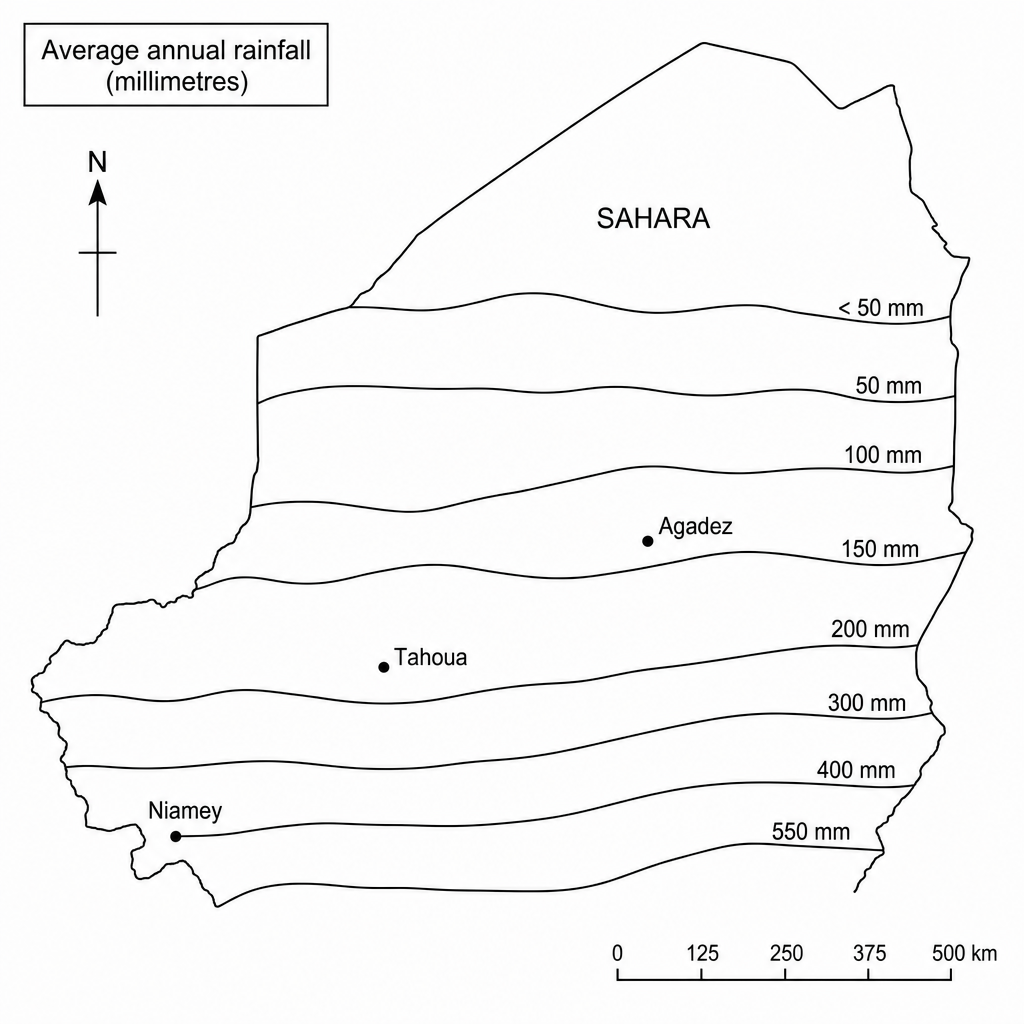
Study Figure 1, a map showing rainfall patterns across Niger.

Figure 1: Map of Niger showing average annual rainfall lines (isohyets). The map shows the capital city Niamey in the south-west, where rainfall is approximately 550 mm per year. Moving northwards through Tahoua towards Agadez and the Sahara Desert, the isohyet lines show progressively lower values, decreasing to 150 mm near Agadez and under 50 mm in the far north of the country.

Identify what happens to the average annual rainfall in a northerly direction from the city of Niamey in Niger.

[1]

Fragile environments and climate change Questions

  1. IGCSE
  2. /Geography
  3. /Fragile environments and climate change
