Marine scientists use sonar pulse-echo systems to map the seabed and locate underwater features.
A research vessel transmits sonar pulses downwards into the water at two different ocean locations:
- Location A has a flat, unobstructed sandy seabed.
- Location B has a dense school of fish located mid-water above the seabed.
The diagram below shows the test setups and the resulting oscilloscope signal traces for both locations.
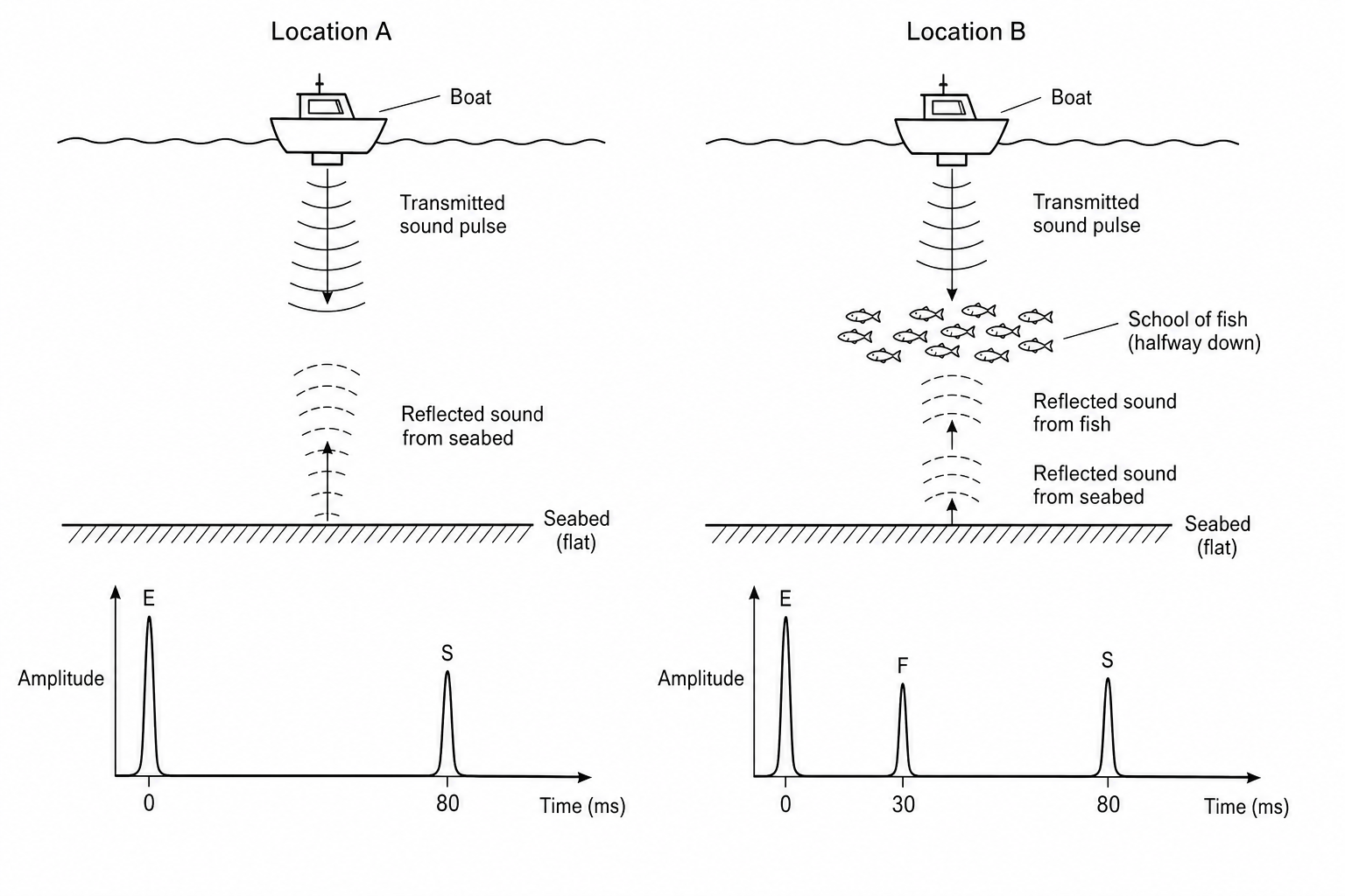
Explain how the signal traces for Location A and Location B show that there is an intermediate obstacle (such as a school of fish) present at Location B.