The big UK pattern
The big UK pattern
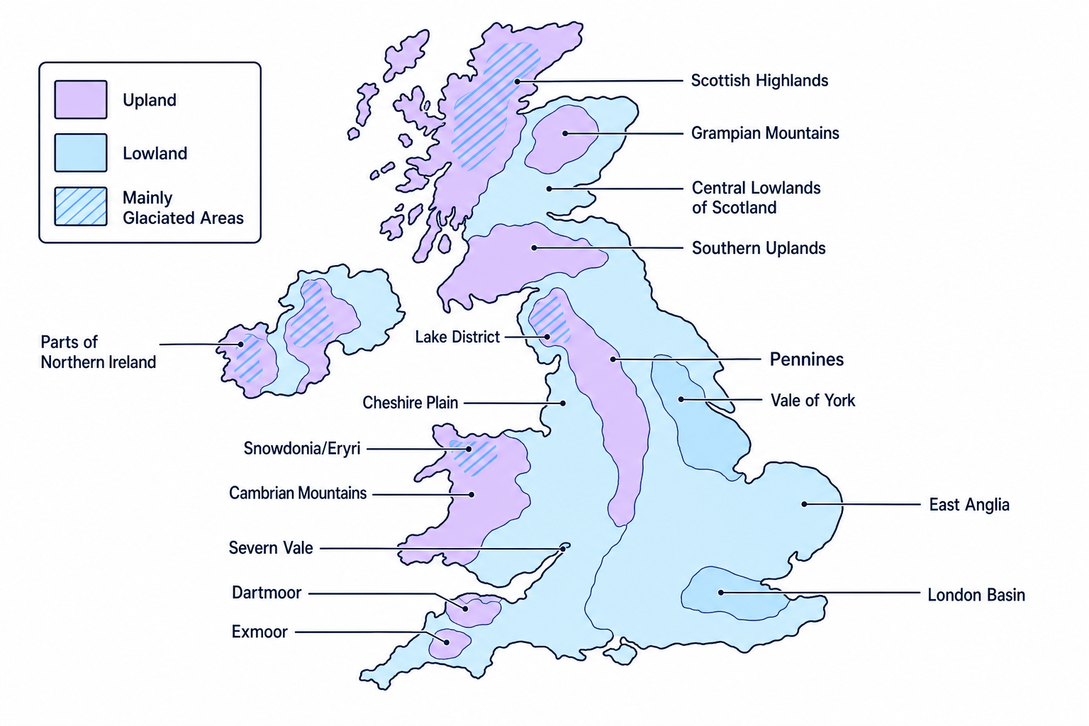
A physical landscape is the visible shape and character of the land, including hills, valleys, rivers, rocks and soils. Across the UK, the broad pattern is that uplands and the strongest glaciated landscapes are mainly in the north and west, while lower lowlands are mainly in the south and east.
UK physical landscapes Lesson
Step-by-step lessons on OCR A GCSE Geography UK physical landscapes. Each one builds up to exam-style questions. Build a solid grasp of core physical and human processes before tackling the evaluation- and decision-making-style questions used in the final papers, which carry the most marks.