Study Figure 12, a map showing upland areas in the United Kingdom that were shaped by glaciation during the last ice age.
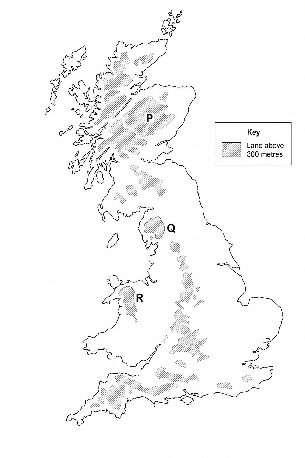
Match the following descriptions of glaciated uplands with the correct letter shown on Figure 12.
| Description of glaciated upland area | Letter |
|---|---|
| A rugged glaciated upland in North Wales, dominated by volcanic peaks, deep glacial troughs (U-shaped valleys), and dramatic arêtes such as Crib Goch. | |
| A high glaciated mountain range in Scotland, located south of the Great Glen Fault, featuring extensive corries, deep glacial troughs, and the highest peak in the British Isles. |