Skip to content
MathsGenie logo
Open app

Course home

  1. IGCSE
  2. Geography Edexcel
  3. Question bank

Urban environments

EasyMediumHard
12345678910111213141516171819202122232425262728293031323334353637383940414243444546474849505152
Question 44

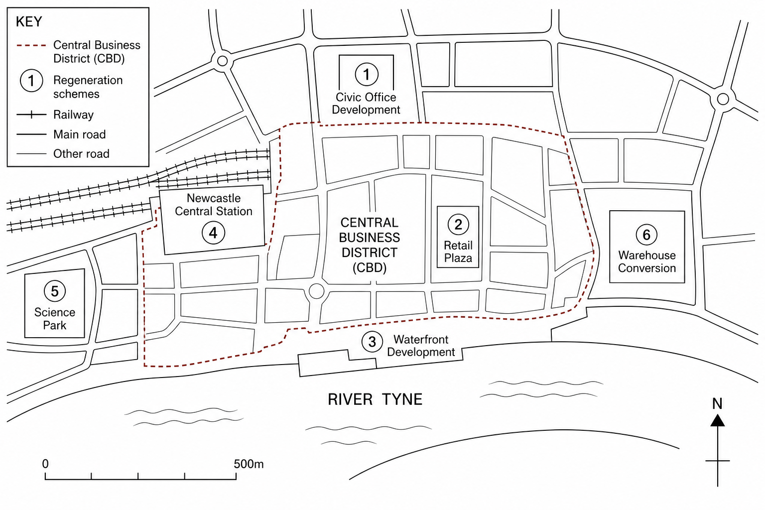
Figure 6: Map of Newcastle upon Tyne, UK, showing urban regeneration projects

Map of central Newcastle showing six key urban regeneration schemes. A red dashed boundary outlines the main Central Business District (CBD). The River Tyne runs along the southern boundary of the city centre. Six numbered symbols indicate different project sites: Project 1 is a civic office development; Project 2 is a major retail plaza redevelopment in the CBD; Project 3 is a cultural and leisure waterfront development situated directly on the banks of the River Tyne; Project 4 is a transport interchange upgrade at Newcastle Central Station; Project 5 is an innovation and science park on the western edge; Project 6 is a warehouse conversion zone for urban housing. A scale bar shows 0 to 500m and a north arrow is visible.

Using Figure 6, suggest one reason why Project 3 (the cultural and leisure waterfront development) was important to the regeneration of the city centre.

[1]

Urban environments Questions

  1. IGCSE
  2. /Geography
  3. /Urban environments
