Skip to content
MathsGenie logo
Open app

Course home

  1. IGCSE
  2. Geography Edexcel
  3. Question bank

Urban environments

EasyMediumHard
12345678910111213141516171819202122232425262728293031323334353637383940414243444546474849505152
Question 3

Study Figure 6a, which shows a map of the city of York and its surrounding rural-urban fringe.
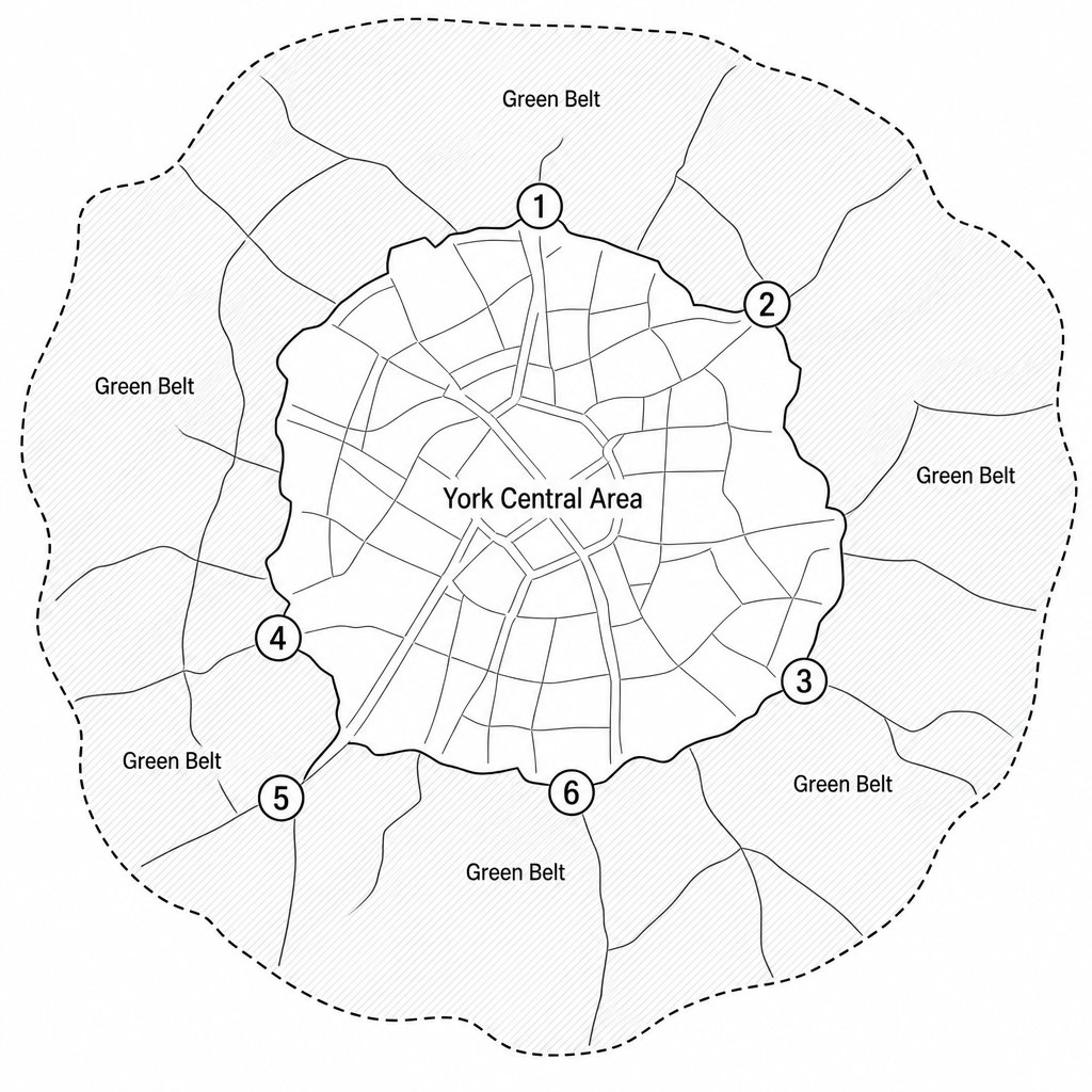
Figure 6a: Map of the city of York, UK, showing the central built-up urban area, the outer city boundary highlighted by a dashed line, and a surrounding shaded Green Belt zone. Six numbered locations are highlighted along the rural-urban fringe where developments are located: Point 1 to the north, Point 2 to the north-east, Point 3 to the south-east, Point 4 to the south-west, Point 5 further south-west, and Point 6 to the south.

Key to Figure 6a

Location / NumberType of Edge-of-City Development
1Clifton Moor (business and retail park)
2Monks Cross (shopping and leisure expansion)
3Heslington East (university campus expansion)
4Askham Bar (park-and-ride transport scheme)
5Copmanthorpe (greenfield housing estate)
6Naburn (designer outlet shopping village)

Using Figure 6a, name one location or development on the edge of the city of York.

[1]

Urban environments Questions

  1. IGCSE
  2. /Geography
  3. /Urban environments
