Skip to content
MathsGenie logo
Open app

Course home

  1. IGCSE
  2. Geography Edexcel
  3. Question bank

Urban environments

EasyMediumHard
12345678910111213141516171819202122232425262728293031323334353637
Question 10

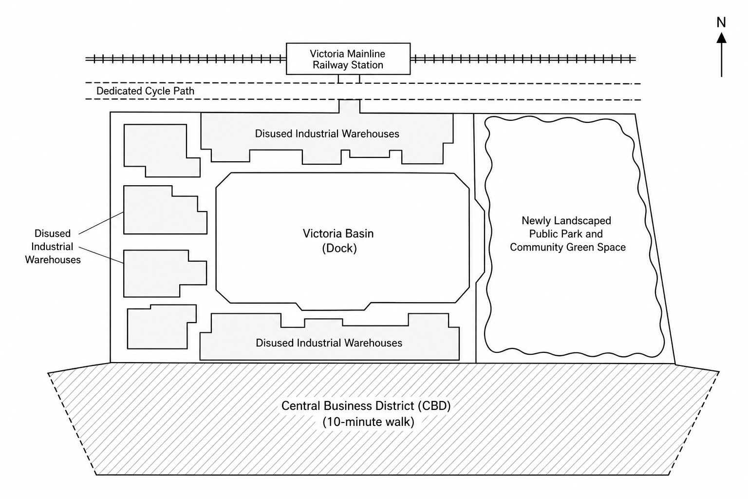
Study Figure 5, a map showing the Victoria Basin brownfield regeneration zone.

Figure 5: Map of the Victoria Basin brownfield regeneration zone. It shows a central water basin (dock) surrounded by disused industrial warehouses. Directly to the north is the Victoria mainline railway station and a dedicated cycle path. To the east is a newly landscaped public park and community green space. To the south is the central business district (CBD) of the city, which is within a 10-minute walk.

Suggest two reasons why the Victoria Basin regeneration zone shown in Figure 5 is a suitable location for residential development.

[5]

Urban environments Questions

  1. IGCSE
  2. /Geography
  3. /Urban environments
