Skip to content
MathsGenie logo
Open app

Course home

  1. IGCSE
  2. Geography Edexcel
  3. Question bank

Globalisation and migration

EasyMediumHard
123456789101112131415161718192021222324252627
Question 19

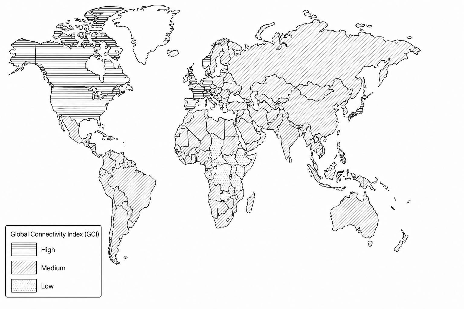
Study Figure 1, which shows the Global Connectivity Index (GCI) across different nations in 2021.

Figure 1: A world choropleth map showing levels of the Global Connectivity Index (GCI) in 2021. High connectivity regions (dark blue/purple) are concentrated in Western Europe (e.g., Germany, UK), North America (e.g., Canada, USA), and East Asia (e.g., Japan, Singapore). Low connectivity regions (light yellow) are predominantly located in Central and East Africa (e.g., Chad, South Sudan, Democratic Republic of the Congo). Moderate connectivity regions (green/orange) include South America (e.g., Brazil) and South Asia (e.g., India).

Suggest two reasons for the uneven pattern of global connectivity shown in Figure 1.
[4]

Globalisation and migration Questions

  1. IGCSE
  2. /Geography
  3. /Globalisation and migration

