Study Figure A and Figure B. Analyse the reasons for the choice of the different coastal engineering strategies shown along this stretch of coastline.
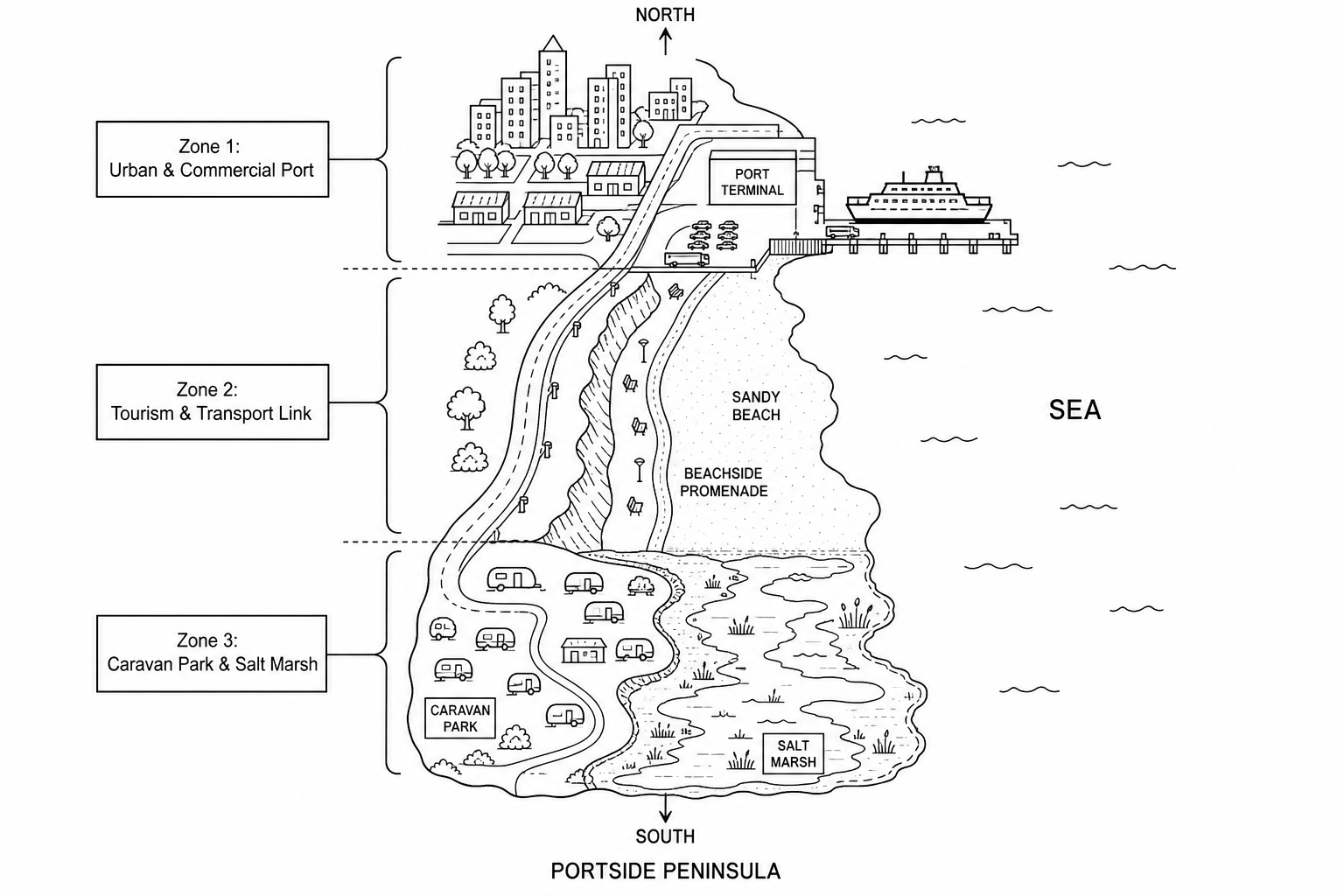
Figure B: Information on coastal engineering strategies used at Portside Peninsula
| Strategy | Location Implemented | Construction Cost | Key Characteristics & Function |
|---|---|---|---|
| Curved Sea Wall | Zone 1 (Ferry Port & Town Centre) | £8,500 per metre | Reinforced concrete wall with a curved lip to deflect wave energy back out to sea; very high durability (80+ years). |
| Rock Armour (Rip-Rap) | Zone 2 (Base of cliffs near coastal road) | £3,500 per metre | Large interlocking Norwegian granite boulders placed at the cliff foot to absorb and dissipate wave energy. |
| Timber Groynes | Zone 2 (Across the sandy tourist beach) | £1,200 per groyne | Low wooden barriers built at right angles to the shoreline to trap sediment moved by longshore drift, widening the beach. |