Coastal environments

EasyMediumHard
12345678910111213141516171819202122232425262728293031323334353637383940414243444546474849505152535455
Question 24
Easy

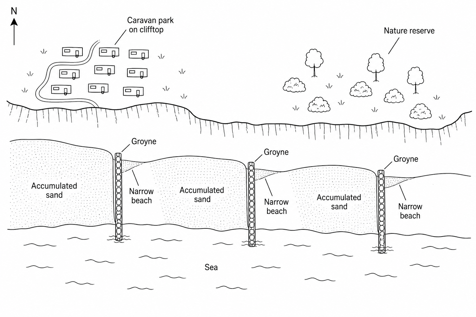
Study Figure 2, which is a sketch map of a managed coastline.

Figure 2: A sketch map of a coastal management scheme at Westbay. The coastline runs from west to east. There is a caravan park on the clifftop to the west, and a nature reserve to the east. Three groynes project from the beach into the sea. On the western side of each groyne, there is a wide, substantial accumulation of sand. On the eastern side of each groyne, the beach is very narrow. A compass arrow pointing to the top of the map indicates North is up.

What evidence is there in Figure 2 that the direction of longshore drift is eastwards?
[1]

Coastal environments Questions

  1. IGCSE
  2. /Geography
  3. /Coastal environments