Skip to content
MathsGenie logo
Open app

Course home

  1. IGCSE
  2. Geography Edexcel
  3. Question bank

Coastal environments

EasyMediumHard
1234567891011121314151617181920212223242526272829303132333435363738394041424344454647484950515253545556575859
Question 24

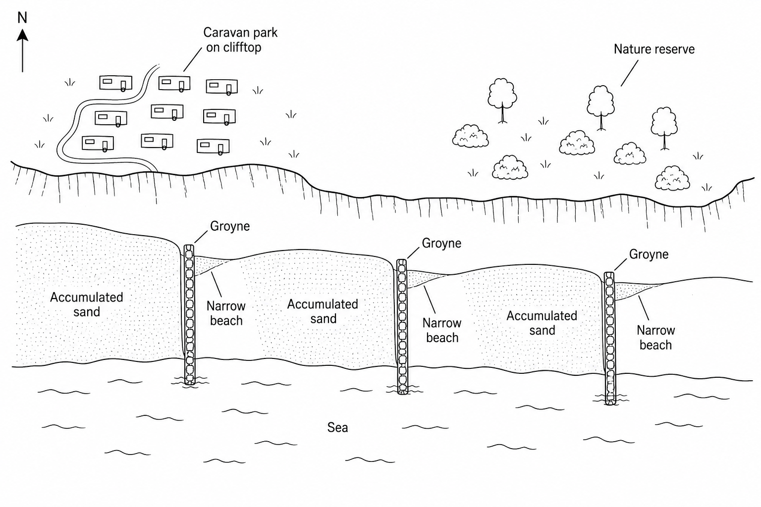
Study Figure 2, which is a sketch map of a managed coastline.

Figure 2: A sketch map of a coastal management scheme at Westbay. The coastline runs from west to east. There is a caravan park on the clifftop to the west, and a nature reserve to the east. Three groynes project from the beach into the sea. On the western side of each groyne, there is a wide, substantial accumulation of sand. On the eastern side of each groyne, the beach is very narrow. A compass arrow pointing to the top of the map indicates North is up.

What evidence is there in Figure 2 that the direction of longshore drift is eastwards?
[1]

Coastal environments Questions

  1. IGCSE
  2. /Geography
  3. /Coastal environments

